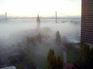
 I’ve decided that after living in San Francisco for a little over 49 years that I’ve chosen to select, Embrace The Fog as my new catch phrase. I’ll start signing emails with it partly because no one signs sincerely any more because that sounds insincere or best which always makes me thing best what? or the usual, regards…regarding what? Your best insincerity? But anyway, let’s get back to the fog.
San Francisco while not being the foggiest place on earth is certainly the best known [Labrador is the foggiest]. The fog is caused by warm moist air hitting colder drier air. When the temperature outside gets close to the temperature needed to get water to condense out of the air as a liquid [dewpoint] you get fog.
San Francisco is odd in that it gets three types of fog and I’ll go into explaining the three types without hopefully putting any of you to sleep the three types are radiation, advection and tule fog. Here we go:
- Radiation fog: is formed by the cooling of land after sunset by thermal radiation in calm conditions with clear sky. The cool ground produces condensation in the nearby air by heat conduction. In perfect calm the fog layer can be less than a meter deep but turbulence can promote a thicker layer. Radiation fogs occur at night, and usually do not last long after sunrise. Radiation fog is common in autumn and early winter. This is what we see at night and in the morning that usually burns off. Tule fog is included in this, but it’s a little different.
- Advection fog: occurs when moist air passes over a cool surface by advection (wind) and is cooled. It is common as a warm front passes over an area with significant snowpack. It is most common at sea when tropical air encounters cooler waters, including areas of cold water upwelling, such as along the California coast. The advection of fog along the California coastline is propelled onto land by one of several processes. A cold front can push the marine layer coastward, an occurrence most typical in the spring or late fall. During the summer months, a low pressure trough produced by intense heating inland creates a strong pressure gradient, drawing in the dense marine layer. Also during the summer, strong high pressure aloft over the desert southwest, usually in connection with the summer monsoon, produces a south to southeasterly flow which can drive the offshore marine layer up the coastline; a phenomenon known as a “southerly surge”, typically following a coastal heat spell. However, if the monsoonal flow is sufficiently turbulent, it might instead break up the marine layer and any fog it may contain. Moderate turbulence will typically transform a fog bank, lifting it and breaking it up into shallow convective clouds called stratocumulus. This is the daytime fog that we get from time to time. It’s also when higher up the overcast cloud layer that we see so often in the Sunset and Richmond districts.
- Tule fog: is a radiation fog, which condenses when there is a high relative humidity [typically after a heavy rain], calm winds, and rapid cooling during the night. The nights are longer in the winter months, which creates rapid ground cooling, and thereby a pronounced temperature inversion at a low altitude. This is the nasty fog that it’s so thick you can sometimes not see your hand in front of your face. It’s the most dangerous type of fog to drive in as it can even obstruct car headlines and don’t even think that turn on your high beams will help as it only shines the light back into your face.
[ad#AdBrite]

